ONLINE HARRISON COUNTY LAND AND LOT AUCTION
Bidding begins closing Tuesday, December 3rd at 6:00PM
20+ Properties in Harrison County – Lumberport
Ranging from 20 Acres, 3 Acres, to Half Acre City Lots and Storage Lots
EAGLE OUTSIDE DISTRICT
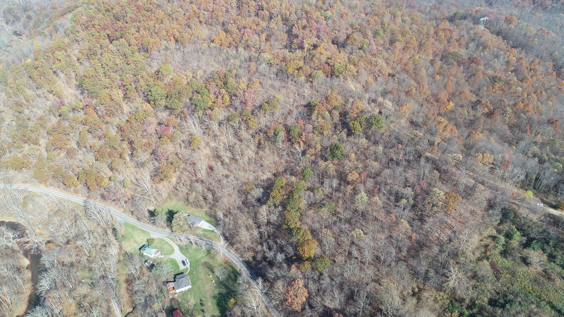
Property #1: 20.05 +/- Acres on Lumberport Rd
20.05 +/- Acres (as assessed)
Mostly Wooded – Potential Timber
Access off Wolfpen Road
Must Call 724-998-5810 Jordan to View
District 9, Map 227, Parcel 8
Legal Description: 20.5 AC TENMILE
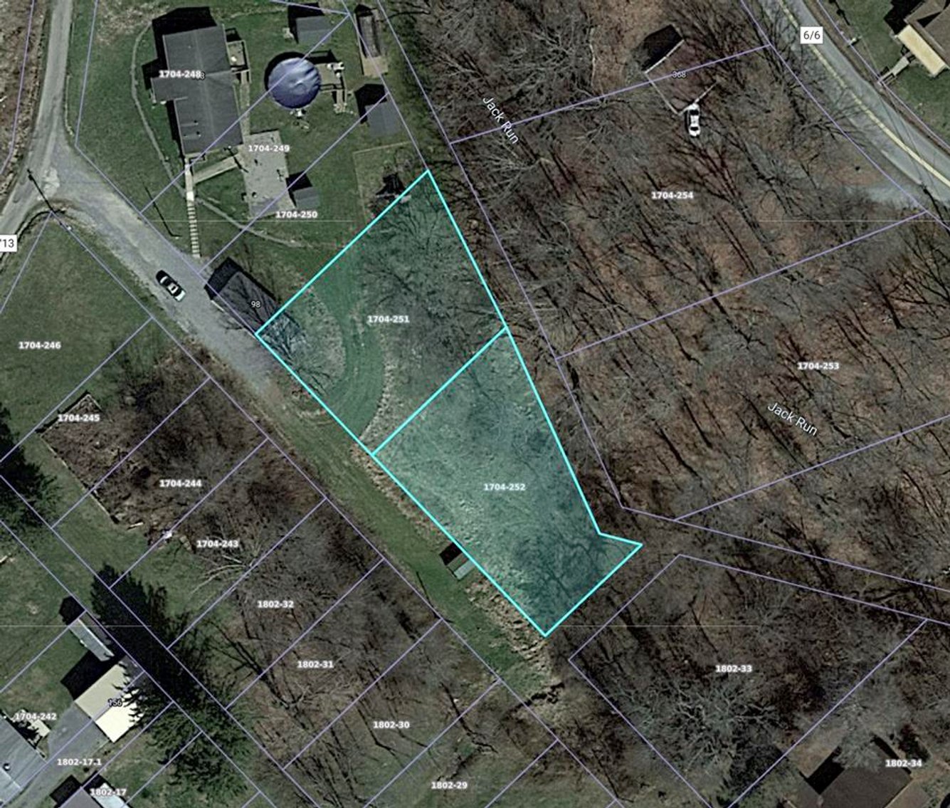
Property #2: 0.42 +/- Acres off Park Rd
0.42 +/- Acres (as assessed)
Two Parcels Totaling 0.42 +/- Acres
Off Park Rd – Locust Street
Closest Address 184 Park Rd Lumberport
District 9, Map 1704, Parcels 251, 252
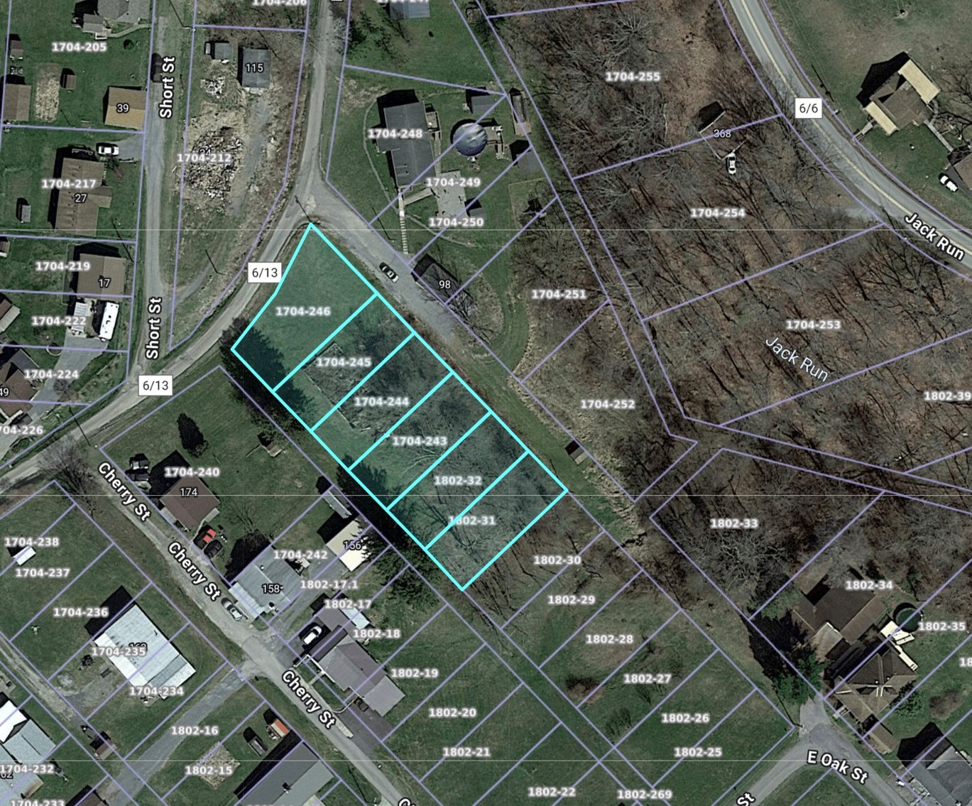
Property #3: 0.63 +/- Acres off Park Rd
0.63 +/- Acres (as assessed)
Six Parcels Totaling 0.63 +/- Acres
Off Park Rd – Locust Street
Closest Address 184 Park Rd Lumberport
District 9, Map 1704, Parcels 243, 244, 245, 246
District 9, Map 1802, Parcels 31, 32
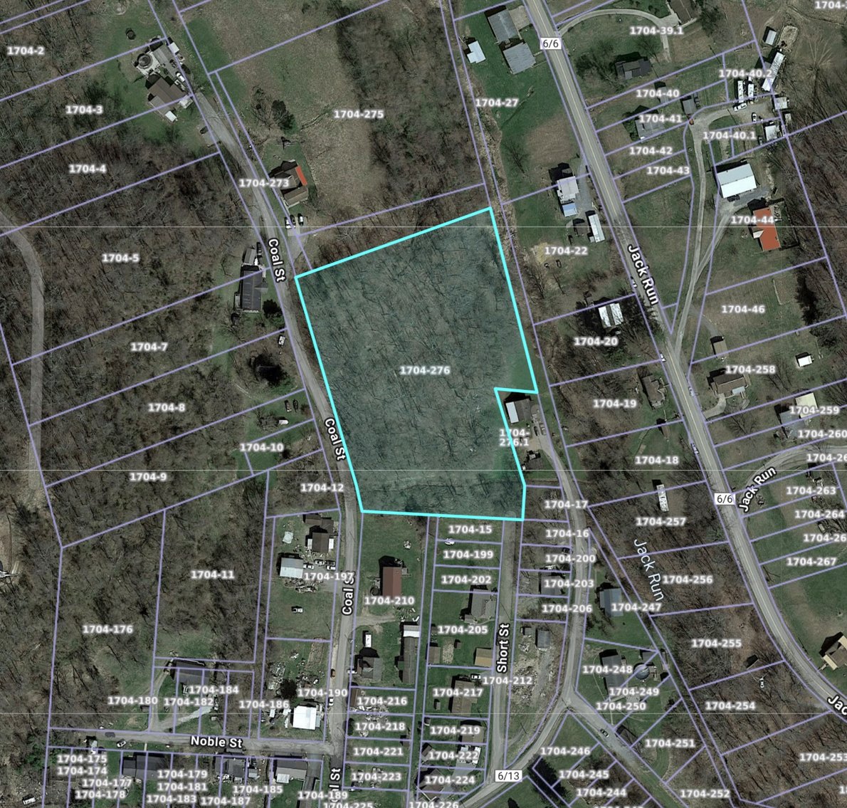
Property #4: 3.11 +/- Acres Off Coal St
3.11 +/- Acres (as assessed)
Off Coal Street
Closest Address 111 Coal St Lumberport
District 9, Map 1704, Parcel 276
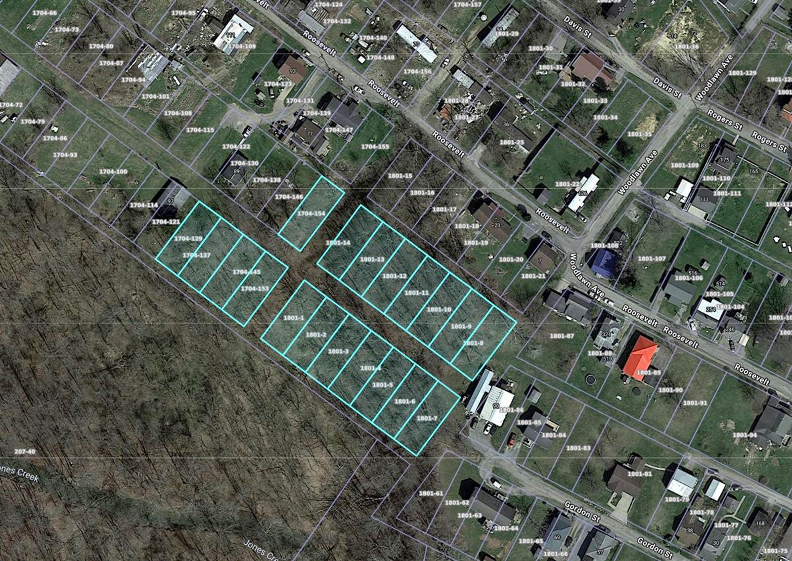
Property #5: 1.90 +/- Acres off Roosevelt St
1.90 +/- Acres (as assessed)
19 Parcels Totaling 1.90 +/- Acres
Off Roosevelt Street, Woodland Ave
Closest Address 36 Roosevelt St
District 9, Map 1801, Parcels 1-14
District 9, Map 1704, Parcels 129, 137, 145, 153
Property #6: 0.30 +/- Acres on Roosevelt St
0.30 +/- Acres (as assessed)
Three Parcels totaling 0.30 +/- Acres
Closest Address 36 Roosevelt St
District 9, Map 1801, Parcels 15, 16, 17
Property #7: 0.11 +/- Acres on Gordon St
0.11 +/- Acres (as assessed)
Closest Address 174 Gordon St
District 10, Map 1801, Parcel 83
Property #8: 0.36 +/- Acres on Davis St
0.36 +/- Acres (as assessed)
Four Parcels totaling 0.36 +/- Acres
Not Contiguous
Closest Address 200 Davis St
District 9, Map 1801, Parcel 42
District 9, Map 1704, Parcels 54, 149, 157
Property #9: 0.75 +/- Acres on Findley Ave
Eagle Outside & Eagle Lumberport Districts
0.75 +/- Acres (as assessed)
Five Parcels totaling 0.75 +/- Acres
Located at the end of Findley Ave on Left
Closest Address 111 Findley Ave
District 9, Map 1801, Parcels 152, 153
District 10, Map 1801, Parcels 151, 154, 155
EAGLE LUMBERPORT DISTRICT
Property #10: 0.23 +/- Acres Corner Lot
0.23 +/- Acres (as assessed)
Two Parcels totaling 0.23 +/- Acres
Corner of Marshall St & Findley Ave
Right Side of Marshall St
District 10, Map 1801, Parcels 149, 150
Property #11: 0.20 +/- Acres on Findley Ave
0.20 +/- Acres (as assessed)
Two Parcels totaling 0.20 +/- Acres
80’ Along Findley Ave
District 10, Map 1801, Parcels 181, 182
Property #12: 0.20 +/- Acres Corner Lot
0.20 +/- Acres (as assessed)
Two Parcels Totaling 0.20 +/- Acres
1/2 Interest in Both Lots
Corner of Marshall St & Findley Ave
Left Side of Marshall St
District 10, Map 1801, Parcels 173, 174
Legal Description: 1 LOT 67 GRIFFIN HTS (1/2 INT)/ 1 LOT 66 GRIFFIN HTS (1/2 INT)
Property #13: 0.38 +/- Acres Corner Lot
0.38 +/- Acres (as assessed)
Three Parcels totaling 0.38 +/- Acres
Corner of Wilson Ave & Findley Ave
119’x119’x171’x100’
District 10, Map 1801, Parcels 175, 176, 177
Property #14: 0.10 +/- Acres on Findley Ave
0.10 +/- Acres (as assessed)
District 10, Map 1801, Parcel 178
Property #15: 0.16 +/- Acres on Short St
0.16 +/- Acres (as assessed)
Off Wilson Ave
District 10, Map 1803, Parcels 10, 12
Property #16: 0.22 +/- Acres on Wilson Ave
0.22 +/- Acres (as assessed)
Two Parcels totaling 0.22 +/- Acres
Off Highland Ave & Wilson Ave
Closest Address 37 Hearth Lane
District 10, Map 1803, Parcels 280, 281
Property #17: 0.98 +/- Acres on Main St
0.98 +/- Acres (as assessed)
Across from Lumberport Baptist
District 10, Map 1803, Parcel 16
Property #18: 0.15 +/- Acres on George St
0.15 +/- Acres (as assessed)
Behind Municipal Building & Water Dept
Good Spot for Billboard
District 10, Map 1803, Parcel 48
Property #19: 0.25 +/- Acres on Main St
0.25 +/- Acres (as assessed)
67’ Along Main Street
Near Post Office
District 10, Map 1803, Parcel 57
Property #20: 0.10 +/- Acres on Washington St
0.10 +/- Acres (as assessed)
Cleared Level Lot
In Front of old Lumberport School
District 10, Map 1802, Parcel 217
Property #21: 0.54 +/- Acres off Locust St
0.54 +/- Acres Off Locust (as assessed)
Mostly Wooded
Behind Lumberport Elementary
District 10, Map 1802, Parcels 183, 184
Property #22: 0.10 +/- Acres off Locust St
0.10 +/- Acres (as assessed)
Single Parcel
Closest Address 410 Locust St
District 10, Map 1802, Parcel 94
Property #23: 0.53 +/- Acres on Depot St
0.53 +/- Acres (as assessed)
Two Parcels Not Contiguous
District 10, Map 1804, Parcel 13, 185
CLAY SHINNSTON CORP DISTRICT
Property #24: 0.15 +/- Acres on Water St
0.15 +/- Acres (as assessed)
Located in Shinnston on Water Street
District 6, Map 1003, Parcel 119
Legal Description: 1 LOT PLANING MILL LOT
Questions? Call Jordan Kiger, Salesperson, at 724-998-5810
Property will be conveyed with free and clear title. 45 Day Closing. All closing costs are the responsibility of Buyer. Real estate taxes are prorated based on the day of closing. Buyer agrees to pay for ALL state and county excise taxes on the privilege of transferring realty (document stamps), preparation of the deed of conveyance, title examination, and any other costs in connection with the procurement of purchase money, including the preparation of necessary instruments such as deeds of trust, if any, and all recording fees incurred pursuant to the transfer of title. All closings will be conducted by BesTitle, 2 Chenoweth Drive Bridgeport, WV.
10% buyer’s premium. 45 days to close. Please read full terms and conditions before bidding.
Property will be sold free and clear of all liens. Seller is conveying surface rights only with no oil, gas, coal, mineral, or other subsurface interests conveyed unless otherwise noted. 45 days given to close. Announcements sale day take precedence over all advertisements published. 10% Buyers Premium will be added to determine final contract price. Name of purchaser on contract must be the name of the winning bidder or an entity which the winning bidder legally represents. No exceptions. Real estate sold subject to owner confirmation unless otherwise noted.
AGENCY DISCLOSURE: Joe R. Pyle Auction and Realty Service is acting as Auctioneer/Agent and is an agent for the seller only.
DISCLAIMER: All information regarding the description of this property is derived from sources deemed reliable but not warranted. Information is believed to be correct to the best of auctioneer/agent’s knowledge but is subject to inspection and verification by all parties relying on it. Sellers, their representatives and auctioneer/agent shall not be liable for inaccuracies, errors, or omissions.
Any references to acreage, unless otherwise noted, are derived from public record and are not warranted. Buyers are responsible for conducting their own research prior to bidding.
BUYER/BROKER INFORMATION: Commission will be paid to any properly licensed buyer's broker who registers a successful buyer according to the Broker Participation Guidelines. Broker registration forms are available on our website or from the company office. Broker must be registered 24 hours prior to Auction. Brokers/Agents are not entitled to a commission if they are the purchaser.
We don't just list your property - WE SELL IT!
JOE R. PYLE COMPLETE AUCTION & REALTY SERVICE
Joe R. Pyle, Broker
(888) 875-1599
5546 Benedum Drive Shinnston West Virginia 26431
www.joerpyleauctions.com
Charlotte Pyle WV2174
Alan Heldreth WV2224
Jordan Kiger WV2246
Bob Stewart, Jr WV825
Bob Stewart, III WV1292
Todd Short WV1649
Tia Wolski WV 2351
Joe Panico WV 2353
Ethan Moore WV 2354
Taylor Ramsey WV2352
Joe Panico WV WV2353
Nick Dawkins WV2410A

